
Post office · Bombay Presidency
NagporePostal Covers & Pre-1854 Postal History
Nagpore postal covers and handstruck postal markings of pre-1854 British India, recorded in an open census: 6 Nagpore handstamps recorded between 1822 and 1859, Bombay Presidency, with 33 Nagpore covers traced to them.
- Handstamps
- 6
- Recorded
- 1822–1859
Nagpore became the capital of the Central Provinces, and is situated 21°9' N and 79°7' E, 520 miles from Bombay and 701 from Calcutta. It stands on a small stream called The Nag, from which it takes its name. It was founded in the 18th century by the Gond Raja, Bakht Buland, and became the headquarters of the Bhonsla Raja. The battles of Sitabaldi and Nagpore were fought here in 1817.
Nagpore has 6 pre-1854 hand-struck postal markings dated 1822–1859 recorded in this census. Each figure links to its covers, rarity and provenance.
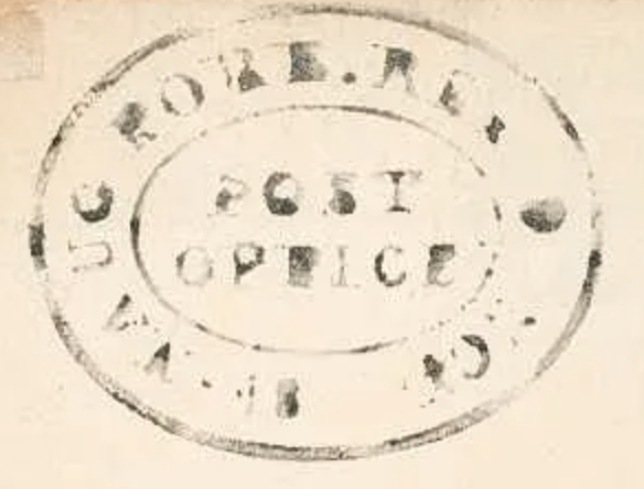

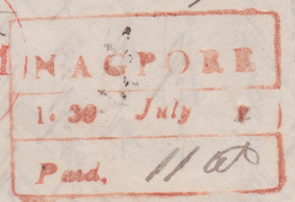


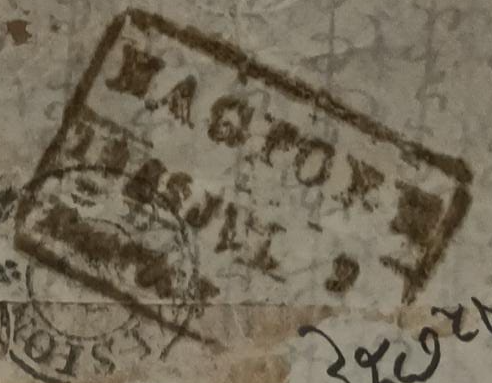
Brown border = community submission, verified by editors
Nagpore handstamp summary
All recorded markings at a glance — click any row for full details and covers.
Nagpore— postal history & markings
Nagpore's six handstamps, from 1822 to 1859, are split evenly between black and red. HG 1 is scarce, and HG 2 carries a catalogue note of its own — it had previously been described as struck in blue in error. The town, taking its name from the small Nag stream, became the capital of the Central Provinces, and its post served that growing administrative centre. Most of its marks are common, but the scarce HG 1 and the corrected record of HG 2 are the entries that reward a close reading — a compact but tidy run from a provincial capital.
Frequently asked — Nagpore postal history
- What are the pre stamp covers of Nagpore?
- Pre stamp (pre philatelic) covers of Nagpore are folded letters and envelopes that passed through the Nagpore post office before India's first adhesive stamp of 1854, so postage was shown entirely by hand-struck postal markings and manuscript rates. Nagpore was a post office of the Bombay Presidency, British India, and this census records 6 distinct postal markings used there, dated between 1822 and 1859.
- How many handstamps are recorded for Nagpore?
- 6 hand-struck postal markings are recorded for Nagpore in this census. Each mark carries its Hammond Giles catalogue figure number, colour, date range, evidence-based rarity grade, and links to every surviving cover recorded with it.
- What is Nagpore called today?
- Nagpore is the colonial-era name of present-day Nagpur, India. Covers and postmarks are catalogued here under the historical name used on the marks themselves.
- How do I identify a Nagpore postmark or cover?
- Compare your cover against the reference impressions on this page — each figure shows the mark's design, ink colour and recorded date range. If your Nagpore cover bears a mark that matches a figure, open that figure's page to see every recorded example with provenance. If it matches none, it may be unrecorded: submit photographs through the form on this page and the editors will review it for inclusion in the census.
For background on the material itself, see the guides to the handstruck stamps of India, the pre covers of India and the pre stamp covers of India, which explain how marks like those recorded at Nagpore were struck, catalogued and graded for rarity.
Also searched as: Nagpore, Nagpur, Nagpore HG 1, Nagpore handstruck stamps, Nagpore pre stamp covers, Nagpore postal history.
How to cite
“Nagpore, Bombay Presidency — pre-1854 handstruck stamps & covers,” Hand Struck Stamps, https://handstruckstampsindia.com/bombay/nagpore (accessed 24 September 2026).
Updated: 24 Sept 2026
An unrecorded mark from Nagpore?
If you hold a cover or strike from Nagpore that does not match any figure above, submit it below. Approved additions appear here as new entries in the census — every submission is reviewed first.
Same presidency
Other post offices in the Bombay Presidency
Explore the pre-1854 postal history of other Bombay Presidency post offices — each page lists its recorded handstruck markings, dates and surviving covers.